Stump Grinding in Woodlawn, TN
Stumps taken out below grade on Montgomery County ground west of Clarksville, measured by diameter and quoted before the wheel turns.
Get a Free Land Clearing Quote in Clarksville
Tell us the acreage, the road it fronts and what the ground has to do afterwards. Form requests are answered the same working day, and every quote follows a site walk.
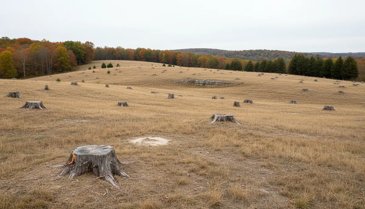
Woodlawn is not a town. The 37191 ZIP covers roughly 42 square miles of western Montgomery County at about 103 people per square mile, some 4,317 of them as of 2022, with a post office and a Clarksville-Montgomery County elementary school near the crossroads at 36.542 north and 87.515 west and no municipal government of any kind. Land here is held in acres rather than lots, and acreage is where stumps accumulate: one for a barn pad, six along a new drive, forty left standing after a timber cut nobody finished.
Clarksville Elite Land Clearing grinds stumps along this stretch of US 79 and the county roads running off it. Grinding is measured work rather than acreage work, priced on the diameter of each stump at grade and the depth the next use of the ground requires, which is a different number under a hay field than under a footing. Where roots have to leave rather than be chipped in place the job is grubbing rather than grinding, and where the stumps are leftovers of a wider job they are usually cheaper attached to one pass over the whole block than counted one by one.
What Woodlawn Ground Does to a Grinding Wheel
Three site facts set the price of a stump here: what is under it, when you can drive to it, and what species it was.
Limestone and voids at grinding depth
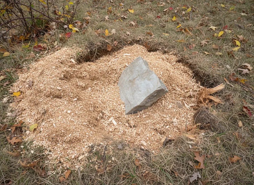
Montgomery County is described as hilly terrain marked by drainages and largely covered with trees, with well-developed karst topography and cave systems, and Dunbar Cave inside the Clarksville city limits is the visible proof of it. The USGS records that sinkholes here are most common where the thickest relatively pure limestones, the Ste. Genevieve and the St. Louis, crop out. Two things follow at the wheel. Rock turns up inside the root plate at depths where a grinder expects soil, which costs teeth and time and is worth knowing before a fixed price is agreed. And water leaving a fresh grinding on karst goes down rather than to a ditch, so the hole is backfilled and settled instead of left open to take the next rain.
Fragipan ground and the spring access window
Dickson silt loam, the Tennessee state soil, carries a fragipan, a dense restrictive subsoil layer that perches water above it after rain instead of letting it through. Clarksville records 50.99 inches of precipitation a year and the wet stretch is concentrated: March, April and May total 14.60 inches with May the wettest at 5.72, while August at 2.95 is the driest month of the year. A grinder still has to reach the stump. On perched ground in April, a machine that would walk in easily in September leaves ruts costing more to repair than the stump cost to grind, so we schedule around it.
Oak, hickory and the size of the root plate
The oak and hickory forest type group accounts for 69.7 percent of Tennessee forest land. By volume the leading species are yellow-poplar at 11.6 percent, white oak at 9.2 and chestnut oak at 8.2, while red maple, yellow-poplar and sweetgum lead on stem count. That mix matters at the wheel: a white oak stump carries far more wood below grade than a sweetgum of the same diameter, and a red maple cut low in a fencerow sprouts back from a plate that was never ground. Eighty-three percent of Tennessee forest land is privately owned, so the stump almost always belongs to a landowner rather than an agency.
Stump Grinding Rules That Apply in Woodlawn, TN
Woodlawn has no city hall, no town clerk and no municipal codes office, so every approval attached to work here is a Montgomery County or a state approval. Facts below were checked on 30 July 2026.
Unincorporated means the county counter, not a town counter
An owner inside an incorporated town deals with that town first and the county second. In Woodlawn there is no first step to skip. Montgomery County Building and Codes is the issuing office for grading and land disturbance work, under Montgomery County Stormwater Management Regulations Resolution #13-2-2 and TDEC Small MS4 Permit number TNS 075621. Grinding a handful of stumps is not a grading project, but once grinding is bundled with drive construction or pad work it is the earth moving around the stumps that pulls the permit.
One acre of disturbed soil is the trigger
Soil disturbance greater than one acre inside Montgomery County follows both TDEC and county stormwater requirements, and Grading, Drainage and Erosion Control plans must be submitted before any earth disturbing activity begins. The county land disturbance application sets a $65 per acre grading permit fee, a $50 per acre plan review fee and a $10 archives and records fee. State coverage runs in parallel under Tennessee construction general permit TNR100000, with the notice of intent filed at least 30 days before work starts and a $250 fee in the 1 to 5 acre band. The county form publishes no floor below one acre, so on a small job we confirm the position with Building and Codes rather than telling you it is exempt.
Locates before the wheel, and what happens to the grindings
Grinding is the clearing service most likely to find a buried line, because the wheel works below grade in the same corridor where water, gas, power and communication services reach a rural house. Tennessee Code 65-31-101 requires at least three working days notice through Tennessee 811, the ticket stays valid 15 calendar days, and the tolerance zone is 24 inches on each side of the marked facility plus the facility width. If debris goes on a burn pile instead of back in the hole, a Tennessee Division of Forestry permit is required from 15 October to 15 May, obtained on the day of the burn, with a firebreak of at least 3 feet through leaves or short grass.
Sources for the requirements above:
- Montgomery County General SWPPP, for the one-acre trigger and Resolution #13-2-2 (https://montgomerytn.gov/storage/departments/stormwater/SWMM%20Chapter%208%20County%20General%20SWPPP.pdf)
- Montgomery County Land Disturbance Permit Application, for the fee structure (https://montgomerytn.gov/storage/departments/stormwater/Land_Disturbance_Permit_Application.pdf)
- Montgomery County Building and Codes permit types, for the issuing office (https://montgomerytn.gov/building-codes/permit-types)
- Tennessee 811, for the notice period and tolerance zone (https://www.tenn811.com/faq)
- Tennessee Division of Forestry burn permits, for the season and firebreak widths (https://www.tn.gov/tnwildlandfire/prevention/safe-debris-burning/permits.html)
Where We Grind Stumps Around Woodlawn
The service area here is the 37191 ZIP rather than a corporate limit, because there is no corporate limit to work from. That is about 42 square miles of western Montgomery County holding roughly 4,317 people at 103 per square mile, which tells you the pattern without a map: long road frontages, deep parcels, houses set well back and timber running to the property line behind them.
US 79 is the spine, carrying traffic between Clarksville and the Stewart County line. The crossroads around the post office and the elementary school is the densest part of the area and the only place where overhead service lines and short setbacks really limit where a machine can park. Everywhere else the limit is the gate and the field entrance. Montgomery County subdivision rules exempt splits creating tracts of five acres or more from Planning Commission review when no street or utility is built, and that exemption shaped this ground: a five-acre tract cut out of woods produces a house site, a drive and a row of stumps nobody planned for.
Those same rules warn that exempt tracts carry no guarantee of adequate access, utilities or soils suitable for an on-site septic system at average cost, which is the position many owners here are in when they call. A stump where a septic field or drive has to go needs the root mass out rather than reduced, and stumps left after a blowdown belong with the rest of the downed material rather than in a separate visit. Southwest the ground runs to the river at Palmyra, covered under selective clearing on that stretch of SR 149.
Land Clearing Services Available in Woodlawn
The four scopes that come up most often on this stretch of US 79.
Stump Grinding
Stumps ground below grade, with the depth set by what the ground carries next and the price set per stump on diameter at grade rather than by the hour.
Clearing and Grubbing
Under footings, pavement or a septic field the root plate is excavated to competent subgrade instead of reduced. Bigger job, different machine, different price.
Land Grading
Grinding leaves holes and mounded chip. Finish grading closes them, sets fall away from a building and gets the surface ready to seed.
Gravel Driveway Installation
Rural drives on deep parcels are why a lot of Woodlawn stumps get ground at all. Stump removal, subgrade and stone run as one scope rather than three visits.
How We Work in Woodlawn
-
Count and measure, do not estimate
Every stump measured at grade, the depth agreed against the next use of the ground, and anything sitting on rock or over a service flagged before a number is given.
-
Locate, then confirm the disturbance area
The 811 ticket goes in on three working days notice, and if grinding is attached to grading or drive work the county position is settled before a date is held.
-
Grind, backfill and settle
Holes filled and compacted rather than left proud, grindings returned or hauled, and the working route repaired if spring ground made a mess of it.
Nearby Communities We Serve
Selective clearing at Palmyra covers the river ground southwest on SR 149, still unincorporated Montgomery County under the same stormwater rules.
Gravel driveway work around Cunningham is the same rural pattern south where SR 13 meets SR 48, with the same five-acre parcels and long private drives.
Clearing and grubbing at Dover picks up west along US 79 past the Stewart County line, where the local permitting step changes.
Storm damage cleanup in Cumberland City is the Cumberland River ground southwest of here, in Stewart County under the stacks of the fossil plant.
Book a Site Walk on Your Acreage
Send the parcel details and we will walk the ground, measure the disturbed area, check the stormwater threshold and put a written scope in front of you before any machine is booked.