Land Grading in Ashland City, TN
Cut, fill and finished grade on Cheatham County ground, from Cumberland River bottomland to the hill lots above it, set so water leaves the building envelope.
Get a Free Land Clearing Quote in Clarksville
Tell us the acreage, the road it fronts and what the ground has to do afterwards. Form requests are answered the same working day, and every quote follows a site walk.
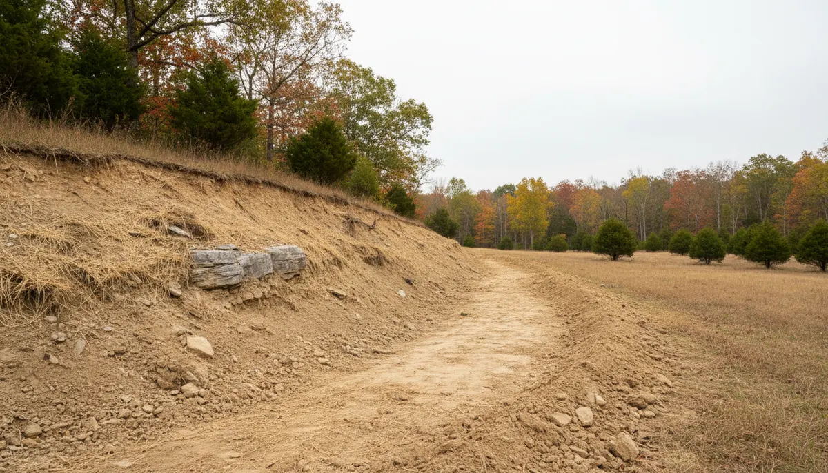
Ashland City was incorporated in 1859 and is the seat of Cheatham County, Tennessee, with 5,193 residents at the 2020 census and an estimated 5,689 by 2024. The town lies on the northeast bank of the Cumberland River, built on bottomland with its residential areas climbing the hills to the north and Sydney's Bluff standing across the water. Cheatham Lake and its lock and dam sit about 11 miles northwest, SR 12 runs northwest toward Clarksville and SR 49 heads west to Charlotte, and the county courthouse dates from 1869. A town split between river flat and hillside is a town where almost every earthwork question is a grading question.
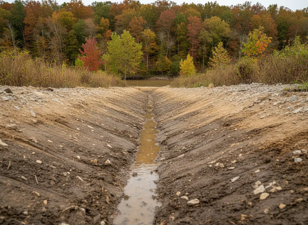
Clarksville Elite Land Clearing grades ground in Cheatham County, which here means two genuinely different jobs sharing one name. On the bottomland the problem is getting water off a nearly level surface and keeping it off. On the hill lots above town the problem is holding a cut face and moving fall away from a structure without pushing it onto a neighbour. Both start with the same question, where water goes after we finish, and both need controls installed as the ground opens rather than at handover. Where standing growth has to come off before shaping starts, that is a clearing scope quoted on its own.
Why Grading in Ashland City Splits Into Two Jobs
The river, the subsoil and the rainfall together explain why one grading method does not serve the whole town.
Bottomland against hillside, inside one municipality
The town proper occupies bottomland on the northeast bank of the Cumberland, with residential development on the hills to its north. That single sentence contains two distinct grading problems. On the flat, fall has to be created and then protected, because a quarter of a percent is the difference between drainage and a standing puddle. On the hillside fall already exists in abundance, and the work is intercepting, slowing and directing it with benches, swales and stabilised faces rather than trying to flatten anything.
Fragipan, and water that will not go down
Dickson, the Tennessee state soil, is a silt loam with a fragipan, a dense restrictive subsoil layer that perches water above it after rain rather than letting it drain through. Mountview is the well-drained companion series on the same Highland Rim landscape. The USGS calls the Western Highland Rim the most dissected of the three Highland Rim subdivisions, and dissected country plus perched water produces wet hollows and soft spots on ground that looks well drained from the road. On a fragipan lot, subsurface drainage is usually what makes surface grading work at all.
A river, a lake and the buffer that comes with them
The nearest published long-term record for this metro shows 50.99 inches of precipitation a year, with May the wettest month at 5.72 inches and August the driest at 2.95. Bulk earthwork wants the drier late-summer window, and anything opened in spring needs its controls in on a much shorter clock. Add the Cumberland running past the town and Cheatham Lake 11 miles northwest, and a large share of local parcels sit within reach of a watercourse, which makes the riparian buffer a live constraint on ordinary residential grading and makes taking material off site safer than sidecasting it toward a drainage.
Land Grading Permits and Requirements in Ashland City, TN
Ashland City is in Cheatham County. The Tennessee instruments below apply here as they do statewide. The local layer is described but not quantified, because we have not verified it. Checked 30 July 2026.
State construction stormwater coverage
The Tennessee construction stormwater general permit, number TNR100000, covers clearing, grading or excavation producing one or more acres of disturbance, and smaller areas forming part of a larger common plan of development. The notice of intent goes through MyTDEC Forms with a site-specific pollution prevention plan, and should be submitted at least 30 days before construction begins. Initial fees start at $250 for one to five acres, rising to $1,000 for five to twenty and $3,000 for twenty to fifty. Grading is named in the trigger, so a pure earthmoving job with no tree on it can land inside this permit.
Stabilisation timing and the riparian buffer
The 2021 permit requires temporary or permanent stabilisation within two weeks after activity ceases in that portion of the site, and within one week where the slope is steep. It requires a 30-foot natural water quality riparian buffer between a waterbody and the disturbed area to the maximum extent practicable, with a minimum acceptable width of more than 15 feet at any measured location. Named controls include silt fence, earth dikes, drainage swales, sediment traps, check dams, pipe slope drains, level spreaders and sediment basins.
Anything that touches the water itself
Altering a stream, river, lake or wetland requires a TDEC Aquatic Resource Alteration Permit or a Section 401 water quality certification, under the Tennessee Water Quality Control Act at TCA Title 69 Chapter 3 and federally under 33 USC 1341 and Section 404. The triggering activities read like a grading scope of works: excavation, channel widening or straightening, bank sloping and stabilisation, water diversions, structural fill, and filling or draining a wetland. Fees are $50 for a personal residence or family farm. General permits typically take three to four weeks and individual permits must be processed within 90 days.
The Cheatham County step, without an invented number
Ashland City and Cheatham County operate their own land disturbance and grading approvals separately from the state permit. We have not verified the Cheatham County thresholds, submittals or fees to a standard that allows publication, so this page does not quote them and does not import figures from a neighbouring county. The local requirement is confirmed with the responsible office before work is scheduled.
Locates and licensing
Tennessee 811 notice is at least three working days, meaning 72 hours excluding weekends and holidays, under Tennessee Code 65-31-101. The tolerance zone is two feet either side of the marked facility plus its own width, and a ticket stays valid 15 calendar days. A contractor licence is required once total project cost reaches $25,000, and the relevant classifications include HRA-A and MU-C for grading and drainage, described by the Board as including grading, drainage pipe and structures, clearing and grubbing.
Sources for the requirements above:
- TDEC stormwater permit TNR100000 (https://www.tn.gov/environment/permit-permits/water-permits1/npdes-permits1/npdes-stormwater-permitting-program/npdes-stormwater-construction-permit.html)
- 2021 Tennessee Construction General Permit (https://tnepsc.org/2021_CGPpdfs/Permit.pdf)
- TDEC Aquatic Resource Alteration Permit (https://www.tn.gov/environment/permits/water/aquatic-resource-alteration-permit--arap-.html)
- Wetland regulation, TCA Title 69 Chapter 3 and Section 404 (https://www.tn.gov/environment/program-areas/wr-water-resources/watershed-stewardship/wetlands/state-and-federal-wetland-regulations.html)
- Tennessee 811 law (https://www.tenn811.com/law)
- Contractor classification outline, HRA-A and MU-C (https://www.tn.gov/content/dam/tn/commerce/documents/regboards/contractors/posts/ClassificationOutlineWeb.pdf)
- Dickson series and its fragipan (https://soilseries.sc.egov.usda.gov/OSD_Docs/D/DICKSON.html)
Areas We Serve in and Around Ashland City
ZIP 37015 covers the town and a good deal of the county around it, and a grading job here is usually described first by which side of the river and which side of the hill it sits on. The bottomland around the 1869 courthouse and the older commercial core is close to level, close to the water and close to neighbours, so grading there is a precision job with short hauls and tight tolerances. The residential ground on the hills to the north is the opposite, with fall to spare and a cut face that has to be held.
Two state routes carry most of the work. SR 12 runs northwest toward Clarksville and is the road most of our Cheatham County jobs arrive along, and SR 49 runs west toward Charlotte through country that turns rural quickly. Parcels on both tend to be long and narrow relative to the road, so the drainage decision is nearly always about the back boundary, where a grading plan stops being visible from the road and starts being somebody else's problem if it is done badly.
Sydney's Bluff across the river is the reminder of what the local relief actually is. Ground that reads as gentle from a driveway can carry twenty or thirty feet of fall across a single lot, and on Highland Rim country the USGS calls the most dissected of its three subdivisions, that is normal.
Northwest of town, Cheatham Lake and its lock and dam sit about 11 miles out, and parcels along that stretch bring the riparian buffer question into almost every conversation. Inland the county runs toward the northern Cheatham ground at Pleasant View.
Land Clearing Services Available in Ashland City
Four scopes that cover most Cheatham County earthwork.
Land Grading
Cut, fill and finished shaping to a stated fall, on bottomland where fall has to be created and on hill lots where it has to be controlled. Quoted from elevations, not a day rate.
Erosion Control
Silt fence, check dams, swales, slope drains, inlet protection and stabilisation, installed to the state permit windows and the 30-foot buffer.
Lot Clearing
Standing growth removed ahead of shaping, with the keep-and-cut line agreed on the ground. On a hill lot the order changes what the finished cut face has to do.
Land Clearing and Excavation
Where the job goes below grade, for basements, ponds, utility runs or structural fill. Drainage features get located before an excavation line is drawn.
How We Work in Ashland City
-
Establish where the water goes first
Before elevations, before machines. High point, low point, outfall, neighbouring property and any blue-line feature inside the buffer distance.
-
Sort the permit path across three levels
State stormwater coverage if the acreage or the common plan triggers it, an aquatic resource permit if the water itself is touched, and the Cheatham County approval confirmed rather than assumed. Then the three working day locate.
-
Shape, control, stabilise
Controls in as the ground opens, bulk earthwork sequenced to the weather, and stabilisation inside the state windows so a new grade is not tested bare by the first heavy rain.
Nearby Communities We Serve
Brush clearing at Pleasant View is the northern end of the same county, 12.6 square miles of Cheatham ground under the same local permit office as Ashland City.
Lot clearing in Springfield sits north across the county line as the Robertson County seat, where lot-by-lot growth rather than earthwork drives most of the work.
Land clearing for home building at Sango is the Montgomery County growth wedge northwest, on the far side of two county boundaries.
Book a Site Walk on Your Acreage
Send the parcel details and we will walk the ground, measure the disturbed area, check the stormwater threshold and put a written scope in front of you before any machine is booked.