Gravel Driveway Installation in Cunningham, TN
Long private drives off SR 13 and SR 48 built with a crown, side ditching and culverts placed where the water already goes.
Get a Free Land Clearing Quote in Clarksville
Tell us the acreage, the road it fronts and what the ground has to do afterwards. Form requests are answered the same working day, and every quote follows a site walk.
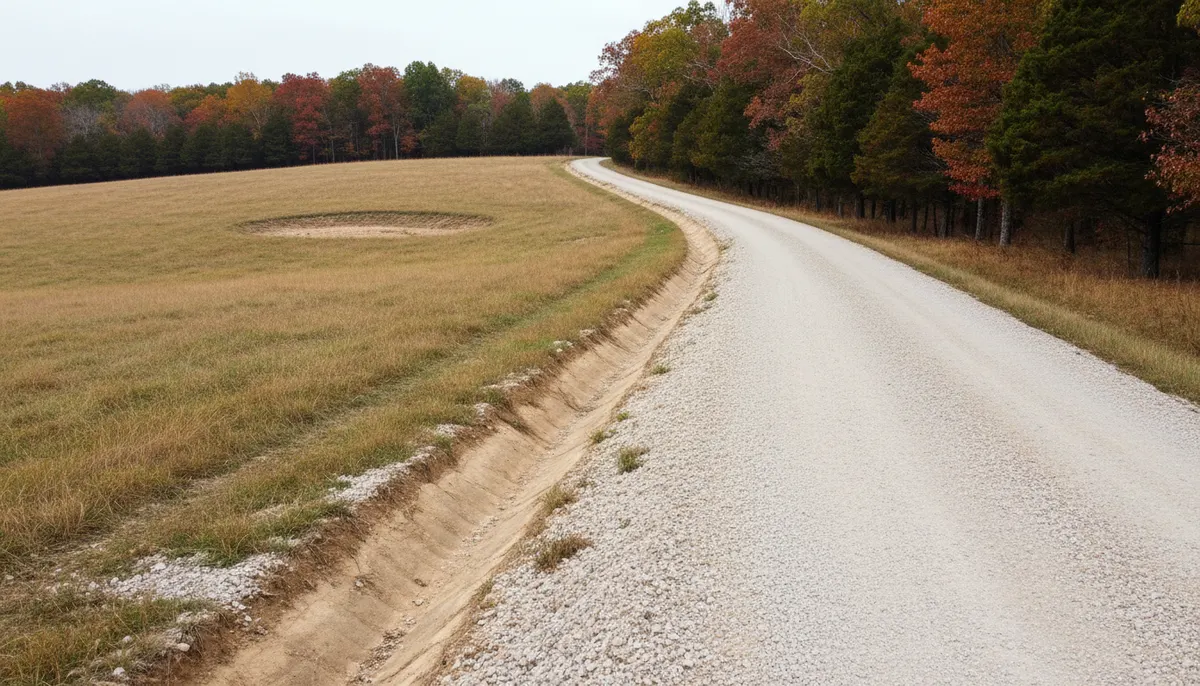
Cunningham is an unincorporated crossroads in Montgomery County where SR 13 meets SR 48, about 9.5 miles south of Clarksville at 36.393 north and 87.387 west, elevation 659 feet, inside ZIP 37052. There is no town limit and no municipal street department, which is the first fact that matters to anyone building access here: every foot of drive between a state route and a house is private and privately maintained.
That is why gravel drive work is the recurring job in this part of the county. Parcels are deep, building sites sit well back from the road, and a drive is usually the first piece of construction on a property and the piece everything else arrives over. A drive that was scraped flat and covered in stone will pump, rut and disappear into the subgrade inside two wet seasons. Clarksville Elite Land Clearing builds them the other way round, starting with where the water goes and finishing with the stone. Where the route has to be opened through standing timber before any of that can happen, the clearing is a separate scope and it is measured by the linear run rather than the acre.
What a Drive Is Built On Around Cunningham
Three ground conditions decide whether a rural drive holds: the subsoil under it, the rock under that, and the length of run the parcel pattern forces on you.
Fragipan subsoil and water that will not drain down
Dickson, the Tennessee state soil, is a silt loam over a fragipan, a dense restrictive layer that perches water above it after rain rather than letting it move down through the profile. A drive built on perched ground fails from underneath: the base loses bearing, stone punches into saturated subgrade, and the surface goes to ruts no matter how much gravel is added on top. That is the argument for a crown and for ditching both sides: water that cannot leave downward has to leave sideways. Rainfall makes the case at 50.99 inches a year locally, a March to May block of 14.60 inches, and August driest at 2.95 inches, which is also the best window for building base.
Karst under the county, and what a culvert sits over
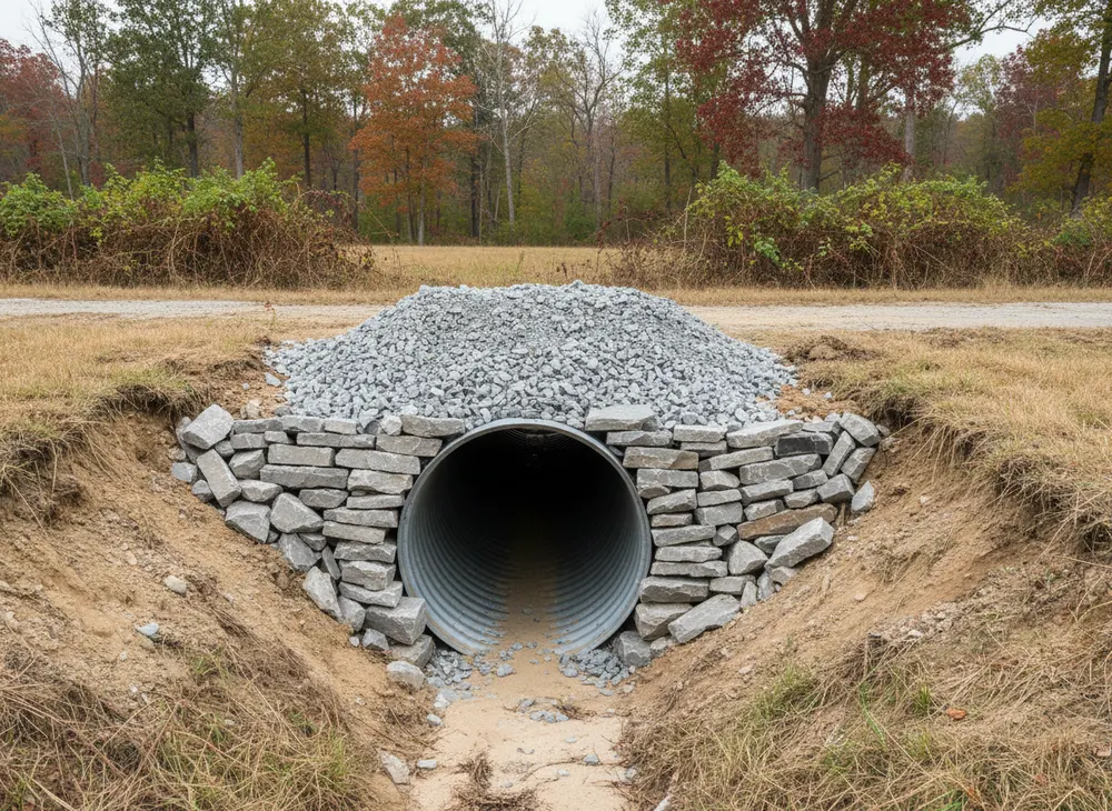
Montgomery County is described as hilly terrain marked by drainages and largely covered with trees, with well-developed karst topography and cave systems. USGS records sinkholes as most common where the thickest relatively pure limestones, the Ste. Genevieve and St. Louis, crop out. Two things follow. Ground under a track is not guaranteed solid, so a new route is walked before it is cut. And on karst, surface water often leaves downward into the ground rather than along a ditch to a stream, so a culvert belongs where water actually goes rather than where the line is straightest.
Five-acre splits and long access runs
County subdivision regulations exempt divisions creating tracts of five or more acres from Planning Commission review where no street or utility is to be constructed, which makes the five-acre tract the standard rural split around here. The same section warns those tracts come with no guarantee of adequate access, utilities, freedom from environmental constraints, or soils able to take a septic system at average cost. Access heads that list for a reason. With the county estimated at 249,935 people in 2025, up 13.6 percent on the 2020 census, and 102,547 housing units, the splits keep coming and each one needs its own drive.
Driveway and Land Disturbance Rules in Cunningham, TN
Cunningham is unincorporated, so there is no city hall involved and the county is the jurisdiction for land disturbance. That changes which office you deal with and which schedule your fee comes off. Facts here were checked on 30 July 2026.
The county threshold, and the arithmetic of a driveway
Soil disturbance greater than one acre in Montgomery County follows the county Stormwater Management Regulations, Resolution #13-2-2, alongside TDEC requirements, with Grading, Drainage and Erosion Control plans required before any earth disturbing activity begins and the Building and Codes Department issuing them. On a non-subdivision project the grading permit is $65 per acre, plan review is $50 per acre, and a $10 archives charge is added. A drive alone often does not reach an acre, since a thousand feet at twenty feet wide is a little under half an acre, but the disturbed width includes ditching, spoil and working room, and a drive is rarely the only thing disturbed on a new build. No threshold below one acre is published, so we confirm the position for your parcel rather than assuming a small job is exempt.
Culverts, ditches and the water permits
Putting a pipe through a wet-weather ditch or a stream is the point where a drive stops being a private matter. TDEC treats road and utility crossings, excavation, channel relocation and bank stabilisation as activities that can require an Aquatic Resource Alteration Permit or a Section 401 water quality certification, under the Tennessee Water Quality Control Act and Section 404 of the Clean Water Act. The fee is $50 for a personal residence or family farm, general permits typically take three to four weeks, and individual permits are processed within 90 days. Where a drive runs near a blue-line stream, the state construction permit also asks for a 30-foot riparian buffer preserved to the maximum extent practicable.
Locates, inspection and stabilisation
Trenching a culvert or setting a headwall is exactly the work Tennessee 811 exists for. Notice is at least three working days under TCA 65-31-101, the tolerance zone is 24 inches on each side of a marked facility plus its own width, and the ticket is valid 15 calendar days. Where a project crosses the county threshold, Montgomery County requires controls inspected by someone with Tennessee EPSC Level 1 certification at least twice a week, no less than 72 hours apart, documented immediately before and after a rain event, with a valid plan kept on site. Disturbed areas need stabilisation within two weeks of activity ceasing, or one week on steep slopes, which on a cut and fill drive means seeding the batters rather than leaving them bare through a wet month.
Sources for the requirements above:
- Montgomery County Chapter 8 County General SWPPP, Resolution 13-2-2, inspection cadence (https://montgomerytn.gov/storage/departments/stormwater/SWMM%20Chapter%208%20County%20General%20SWPPP.pdf)
- Montgomery County Land Disturbance Permit Application, grading and plan review fees (https://montgomerytn.gov/storage/departments/stormwater/Land_Disturbance_Permit_Application.pdf)
- TDEC Aquatic Resource Alteration Permit, road and utility crossings, fees and timeframes (https://www.tn.gov/environment/permits/water/aquatic-resource-alteration-permit--arap-.html)
- Tennessee CGP TNR100000, stabilisation timing and riparian buffer (https://tnepsc.org/2021_CGPpdfs/Permit.pdf)
- Tennessee 811 notice period, tolerance zone and ticket validity (https://www.tenn811.com/faq)
Areas We Serve Around Cunningham
SR 13 and SR 48 are the two routes everything here hangs off, and the drives we build almost always start on one of them or on a county road running back from them. Montgomery Central High School, with its three-dome mid-century modern campus built in 1968, is the landmark at the centre of the community and the reference point most people use when describing where a property sits inside ZIP 37052.
This is old tobacco country. J.T. Cunningham, who gave the place its name, served as Speaker of the Tennessee House and was the first president of the Eastern Dark-Fired Tobacco Growers Association, and the field pattern that history left behind still shapes access today. Old farm lanes exist on many of these parcels, and the question we get asked most is whether one can be upgraded rather than rebuilt. Often it can, because a lane that has been on the ground for decades has found its own drainage and compacted its own subgrade. Where it has closed in, taking the brush off it comes first. Where it crosses a low spot that has always been wet, moving the route beats fighting it every year.
Grade is the other variable. Terrain here is rolling rather than flat, and a climbing drive needs cross drainage at intervals or the running surface becomes the watercourse. That is decided at the walk, not with a bag of stone later. Northwest of here the same conditions run through the river country around Palmyra on SR 149.
Land Clearing Services Available in Cunningham
Four scopes that build and keep rural access on this ground.
Gravel Driveway Installation
Route walked, subgrade prepared, crown built, ditching cut both sides and culverts set where water already runs, then stone placed and compacted in lifts rather than dumped and spread.
Land Grading
Shaping the ground either side of the running surface so water leaves the drive instead of following it, including cut and fill on climbing sections and batters left at a slope that will hold.
Erosion Control
Silt fence, check dams and seeding on the cut faces and ditch lines, placed inside the two-week stabilisation window the state permit sets once work in an area stops.
Site Preparation
The pad at the end of the drive. Stripped, shaped and compacted to a subgrade a builder can work from, with the drainage tied into the same plan as the access route.
How We Work in Cunningham
-
Walk the route in wet conditions if we can
A drive line looks fine in August. The low spots, seeps and wet-weather crossings that decide culvert placement show up after rain, and that is the version of the route we price.
-
Place locates and confirm the county position
Tennessee 811 notice before any trench or headwall, and the county requirement checked against the actual disturbed area rather than the width of the running surface.
-
Build drainage first, stone last
Crown, ditch and culvert go in before the surface course, and the stone is placed in lifts and compacted. Stone laid over unresolved drainage is a repeat visit rather than a driveway.
Nearby Communities We Serve
Commercial clearing at Southside is the head service east along the US 48 and 13 corridor, still unincorporated Montgomery County ground.
Farm clearing down at Erin follows SR 13 south into Houston County, entirely rural country where access runs are longer again.
Stump grinding in Woodlawn covers the US 79 corridor northwest of here, unincorporated and under the same county permit counter.
Book a Site Walk on Your Acreage
Send the parcel details and we will walk the ground, measure the disturbed area, check the stormwater threshold and put a written scope in front of you before any machine is booked.