Land Clearing for Home Building in Sango, TN
Build pads, drives and utility runs opened on the southeastern growth wedge, grubbed and shaped for a footing crew rather than just knocked down.
Get a Free Land Clearing Quote in Clarksville
Tell us the acreage, the road it fronts and what the ground has to do afterwards. Form requests are answered the same working day, and every quote follows a site walk.
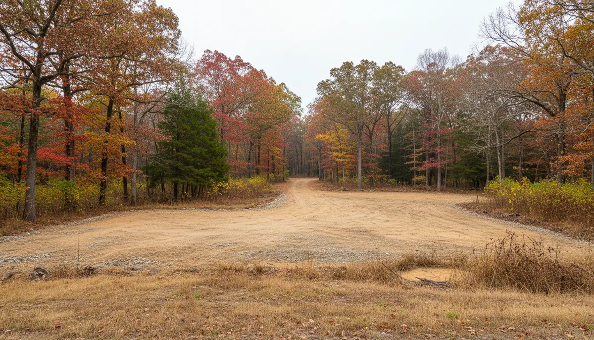
Sango has no corporate limit, no city hall and no formally defined boundary. It is unincorporated Montgomery County, a name applied to the southeastern wedge that runs from US 41A out to just beyond I-24, roughly five miles east of downtown Clarksville at an elevation of 643 feet, inside ZIP 37043. That missing boundary is not trivia. It decides which office a landowner deals with when the first machine arrives, and it is the thing people most often get wrong here, because the postal address points at Clarksville while the permit counter does not.
The reason clearing work concentrates in this wedge is direction. Sango is the part of the county that faces Nashville, and I-24 is why. Ground that was pasture or mixed hardwood is turning into house sites one parcel at a time, mostly through individual owners and small builders rather than a single large developer. Clarksville Elite Land Clearing works those parcels from standing timber to a pad a footing crew can set string lines on, treating the tree work, the root mat, the topsoil strip, the drive and the drainage as one sequence. Where a lot is small enough that the whole job is one pass, lot clearing is the narrower scope.
What Building Ground in Sango Is Actually Made Of
Three conditions decide how a Sango parcel behaves once the trees come off: the rock underneath, the subsoil above it, and the pace of building around it.
Karst limestone and the voids in it
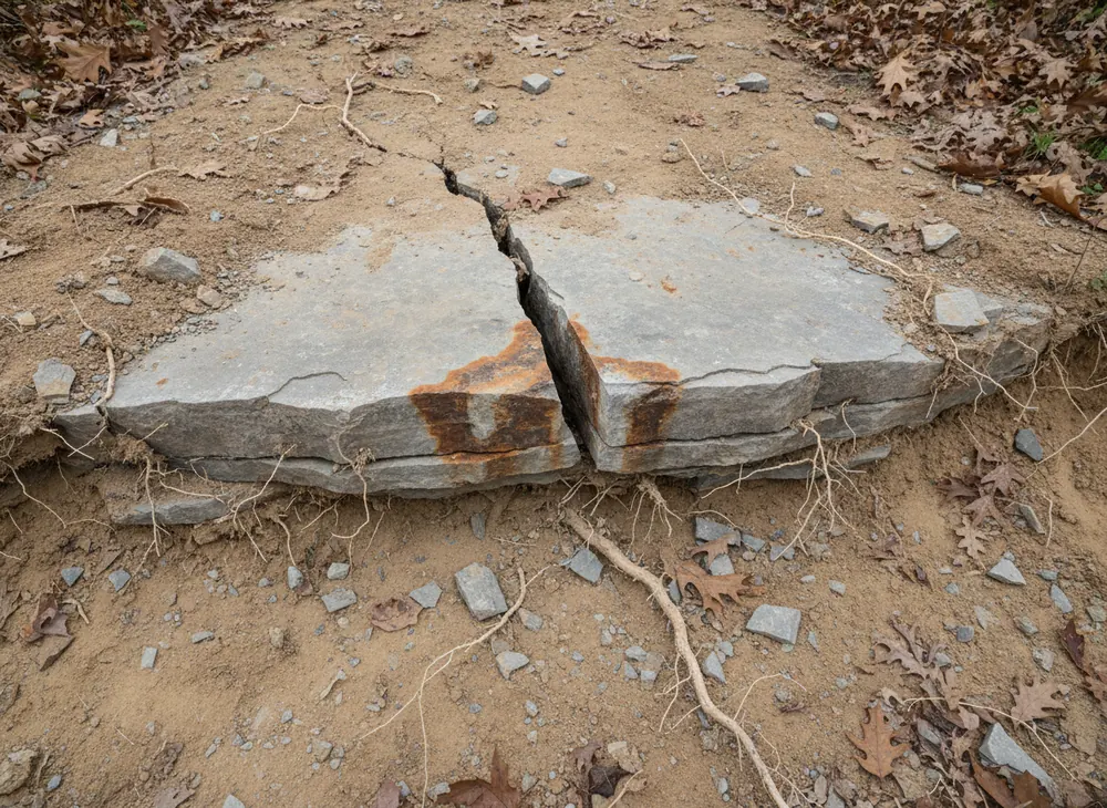
Clarksville and the ground east of it sit at the junction of the Western Highland Rim and the Pennyroyal Plateau. USGS calls the Western Highland Rim the most dissected of the three Highland Rim subdivisions and describes the Pennyroyal as a sinkhole plain carrying a high density of sinkholes and related features including deep vertical shafts and blind valleys, most common where the thickest pure limestones such as the Ste. Genevieve and St. Louis crop out. Dunbar Cave is the visible local proof. Two consequences follow for a build pad: dozer and grubbing work has no guarantee of solid ground under the track, and stormwater off a stripped surface can go into the ground rather than along a ditch to a stream.
Fragipan subsoil under the pad
Dickson is the Tennessee state soil, a silt loam with a fragipan, a dense restrictive layer that perches water above it after rain instead of letting it drain through. Perched water under a pad is a footing and slab problem long after the clearing crew has gone, which is why the strip and the drainage plan belong to one conversation. The local rainfall record shows 50.99 inches a year, a March to May block of 14.60 inches and August driest at 2.95 inches, so spring is tracked low ground pressure work and late summer into early autumn is the clean window for heavy dozer and grubbing work.
Building pressure and the five-acre split
Montgomery County was estimated at 249,935 people in 2025, up 13.6 percent since the 2020 census, with 102,547 housing units and a median home value of $280,200 across 539.17 square miles at 408.2 people per square mile. County subdivision regulations exempt divisions creating tracts of five or more acres from Planning Commission review where no street or utility is to be constructed, which is why the five-acre tract is the standard rural fringe parcel. The same section warns those tracts carry no guarantee of adequate access, utilities, freedom from environmental constraints, or soils able to take a septic system at average cost. That warning describes most parcels we are asked to clear here.
Land Clearing Permits for Home Building in Sango, TN
Sango is unincorporated, so the City of Clarksville stormwater ordinance is not the instrument that governs it. Montgomery County is. That is the whole point of this section. Facts here were checked on 30 July 2026.
Unincorporated means the county counter, and the county has a published schedule
Soil disturbance greater than one acre in Montgomery County follows the county Stormwater Management Regulations, Resolution #13-2-2, alongside TDEC requirements, under the county MS4 permit TNS 075621. Grading, Drainage and Erosion Control plans must be submitted before any earth disturbing activity begins, and the issuing office is the Montgomery County Building and Codes Department, open Monday to Friday from 7:30 AM to 4:30 PM. The non-subdivision fee stack is a grading permit at $65 per acre, a plan review at $50 per acre and a $10 state archives charge. Subdivision projects run instead on a tiered band from $250 to $1,000 by disturbed acreage. No threshold below one acre is published, so we confirm rather than assume a small lot is exempt.
The state permit stacks on top, and the common plan clause catches small lots
Coverage under the Tennessee construction general permit, TNR100000, is triggered by clearing, grading or excavation disturbing one or more acres, or less than an acre where the work is part of a larger common plan of development. That clause matters for home building, because a half-acre lot inside a subdivision is not automatically outside the permit. The notice of intent, form CN-0940, goes through MyTDEC Forms at least 30 days before construction starts, with a site-specific stormwater pollution prevention plan alongside it, and initial fees run $250 at 1 to 5 acres and $1,000 at 5 to 20. Stabilisation is required within two weeks of activity ceasing in an area, or one week on steep slopes, and a 30-foot riparian buffer is preserved to the maximum extent practicable.
Inspection, locates and the licence threshold
Montgomery County adds an inspection standard to the state one: controls inspected by someone holding Tennessee EPSC Level 1 certification at least twice a week and no less than 72 hours apart, documented immediately before and after any rain event, with a valid plan kept on site. Locates run through Tennessee 811 under TCA 65-31-101 with at least three working days notice, a 24-inch tolerance zone either side of a marked line, and a ticket valid 15 calendar days. Burning needs a Tennessee Division of Forestry permit between 15 October and 15 May, issued for the day of the burn. A contractor licence applies once total project cost reaches $25,000, under classification HC-5, "Clearing, Grubbing, Snagging and Rip Rap".
Sources for the requirements above:
- Montgomery County Chapter 8 County General SWPPP, Resolution 13-2-2 and the one-acre trigger (https://montgomerytn.gov/storage/departments/stormwater/SWMM%20Chapter%208%20County%20General%20SWPPP.pdf)
- Montgomery County Land Disturbance Permit Application, grading and plan review fees (https://montgomerytn.gov/storage/departments/stormwater/Land_Disturbance_Permit_Application.pdf)
- Montgomery County Building and Codes permit types and office hours (https://montgomerytn.gov/building-codes/permit-types)
- Tennessee CGP TNR100000, notice of intent, stabilisation and riparian buffer (https://tnepsc.org/2021_CGPpdfs/Permit.pdf)
- Tennessee 811 law and notice requirements, TCA 65-31-101 (https://www.tenn811.com/law)
Areas We Serve Across Sango
Because there is no boundary line to point at, we work Sango as a corridor rather than a jurisdiction. The US 41A frontage is its western edge, I-24 the eastern reference, and the parcels between them mix long-held farm ground, older homesteads on deep lots and newer house sites cut into standing timber. The Bagwell Road and Sango Road intersection is the historic centre of the name, remembered as a flashpoint in the tobacco wars of 1904 to 1908, and still a useful landmark when a rural address gives you nothing.
Parcel shape here drives cost more than acreage does. A rectangular five-acre tract with road frontage and a flat building envelope is a straightforward clear and strip. A long narrow tract needing several hundred feet of drive cut before a machine can reach the building envelope is a different job, and the drive is often the larger half of it. We measure the access run separately and quote it as its own item rather than folding it into a per-acre rate.
The other Sango variable is what stays. Buyers here often want the road frontage screened and the rear canopy intact, which turns a clearing job into a partly retained one. Where that is the brief, taking the understory and leaving the mature stems is a separate scope, and it needs deciding before the first tree comes down. South of here the same growth pattern reaches the county's southeast corner around Southside.
Land Clearing Services Available in Sango
Four scopes that carry a Sango parcel from timber to a buildable site.
Land Clearing for Home Building
Standing vegetation, root mat and topsoil taken off the building envelope, then the pad shaped and compacted for a footing crew, with the drive and the drainage handled in the same sequence.
Site Preparation
The grading stage after clearing: cut and fill balanced on site where possible, subgrade prepared, finished elevations set against the drainage plan rather than the existing ground.
Clearing and Grubbing
Removal of the root mass, not just the stems. This is the step that prevents settlement under a slab or a drive, and the one most often skipped on a cheap quote.
Erosion Control
Silt fence, check dams, inlet protection and stabilisation to the standard the county and state permits require, including the two-week clock once work in an area stops.
How We Work in Sango
-
Walk the parcel with the plan
Building envelope, drive route, spoil area and low point identified on the ground. Karst features and wet-weather drainage are noted before pricing, because both change the machine and the sequence.
-
Confirm the county path
Disturbed acreage calculated, the county requirement checked against it, and the state notice of intent filed on its 30-day lead where the acreage or common plan clause requires.
-
Clear, grub, then shape
Vegetation off, root mat out, topsoil stockpiled for reuse, pad shaped and compacted, controls in and stabilisation started inside the permit clock.
Nearby Communities We Serve
Gravel drive work at Cunningham is the head service southwest at SR 13 and SR 48, unincorporated ground under the same county counter.
Brush clearing in Pleasant View covers the next community down I-24, over the line in Cheatham County, where a different codes office takes over.
Land grading around Ashland City is the Cumberland River bottomland at the Cheatham County seat, reached on SR 12 and I-24.
Book a Site Walk on Your Acreage
Send the parcel details and we will walk the ground, measure the disturbed area, check the stormwater threshold and put a written scope in front of you before any machine is booked.