Lot Clearing in Springfield, TN
Residential and commercial lots in Robertson County stripped to a buildable surface, priced by the acre and by what is standing on it rather than by the hour.
Get a Free Land Clearing Quote in Clarksville
Tell us the acreage, the road it fronts and what the ground has to do afterwards. Form requests are answered the same working day, and every quote follows a site walk.
Springfield was incorporated in 1819 and is the seat of Robertson County, Tennessee, holding 18,782 residents at the 2020 census and an estimated 19,842 by 2024 across 13.32 square miles at an elevation of 666 feet. US 41 and US 431 run north to south through it and SR 76 and SR 49 cross east to west, which is why the town has always accumulated frontage parcels faster than it consumes them. Around 53 inches of rain and 5.8 inches of snow land here in an average year, and that number decides how long a cleared lot sits exposed before it has to be stabilised.
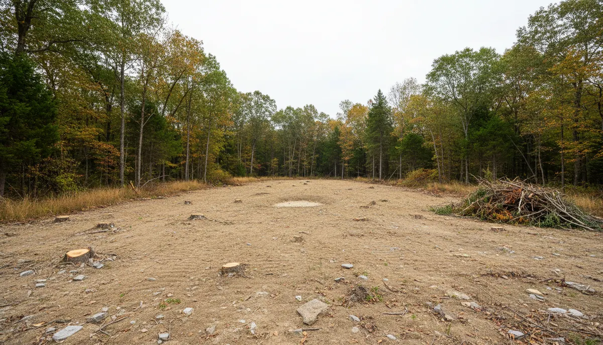
Lot clearing is the scope most often asked for here because growth arrives one parcel at a time rather than in large tracts. Clarksville Elite Land Clearing takes a Robertson County lot from standing timber and undergrowth to a surface a surveyor and a footing crew can work on, with the stump and root decision made deliberately rather than left to whoever shows up next. A lot going under a house has a different finish standard from a lot opened for a view or a paddock, so the home-building version of this work is quoted separately, and stumps left on a lot that will later be mowed become a grinding job.
What a Springfield Lot Is Actually Made Of
Three things decide the price and the sequence on a lot here: the subsoil, the species standing on it, and the rain.
Fragipan under the topsoil
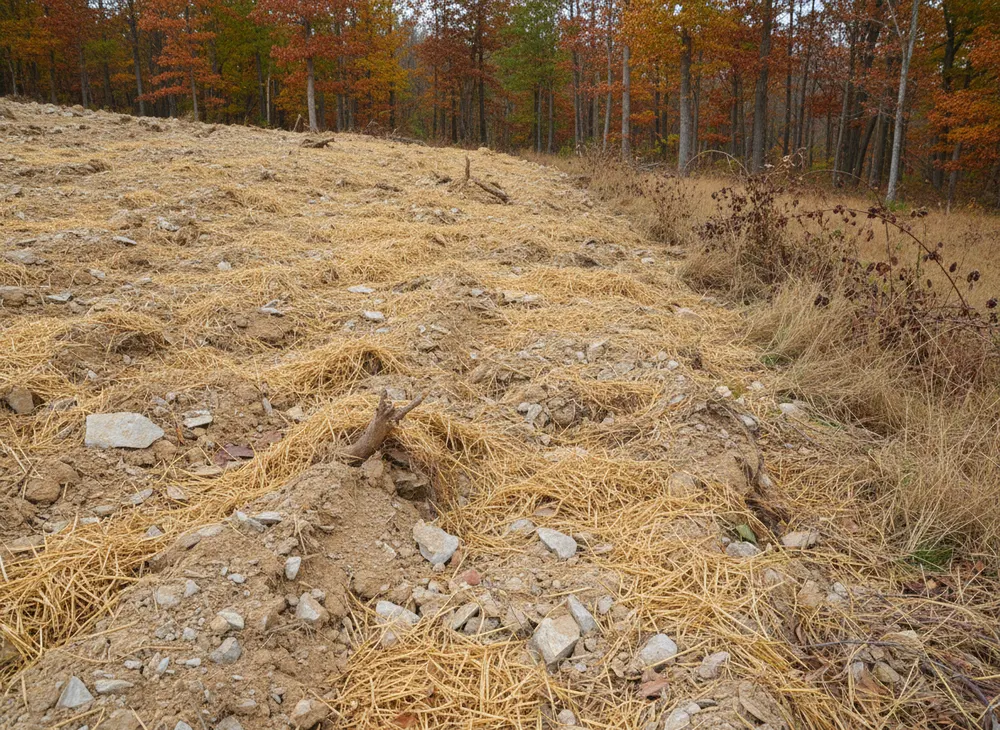
The Tennessee state soil, the Dickson series, is a silt loam carrying a fragipan, and that is the most important thing to understand before a machine turns a wheel here. A fragipan is a dense, restrictive subsoil layer that perches water above it after rain instead of letting it drain through. The associated Mountview series is the well-drained counterpart on the same Highland Rim landscape. On a fragipan lot, water sits in the top of the profile for days after a storm, tracked equipment marks the ground more easily than the surface suggests, and any assumption that water leaves downward is wrong.
Oak and hickory, and what regrows under it
The Forest Service inventory puts the oak and hickory forest type group at 69.7 percent of Tennessee forest land. By volume the leaders are yellow-poplar at 11.6 percent, white oak at 9.2 and chestnut oak at 8.2, but by stem count the order changes to red maple at 9.6 percent, yellow-poplar at 6.9 and sweetgum at 5.6. That gap is the lot clearing story in one statistic. The big trees are oak and poplar, and the thicket you have to get through to reach them is maple and sweetgum, which regrow from cut stumps and will be back inside three seasons if the roots stay in the ground.
Fifty-three inches of rain and a spring peak
The nearest published monthly breakdown in this metro puts the wettest month at 5.72 inches in May, with December at 4.94 and November at 4.51, against a driest month of 2.95 inches in August. A lot cleared in March is therefore exposed through the wettest three months of the year, which is why the stabilisation deadline in the state permit is not a paperwork detail on this ground. Late summer into early autumn is the cleanest window for the heavier end of the job, and holding the soil on the cleared face is part of the scope in any season.
Lot Clearing Permits and Requirements in Springfield, TN
Springfield is in Robertson County, not Montgomery County, and the local layer differs accordingly. Below are the Tennessee instruments that apply statewide, plus the local step described honestly. Checked 30 July 2026.
State stormwater coverage, set in Nashville rather than at the county line
The Tennessee construction stormwater general permit, number TNR100000, covers clearing, grading or excavation resulting in an area of disturbance of one or more acres, and also under an acre where the work is part of a larger common plan of development. The notice of intent goes through MyTDEC Forms with a site-specific pollution prevention plan, and the permit states the complete application should be submitted at least 30 days before construction begins. Initial fees run $250 at one to five acres and $1,000 at five to twenty. Those are state figures and they apply in Robertson County as anywhere else in Tennessee.
The local land disturbance step, stated without a number
Above the state permit, the City of Springfield and Robertson County operate their own land disturbance and grading approvals, separate from the state process rather than a substitute for it. We have not verified the Springfield or Robertson County thresholds, submittals or fees to publication standard, so this page quotes none of them and does not carry Montgomery County figures across the county line. We confirm the local requirement for your parcel before work is scheduled.
Stabilisation, buffers and inspection
The 2021 state permit requires temporary or permanent stabilisation within two weeks after activity in that portion of the site has ceased, and within one week on steep slopes. A 30-foot natural riparian buffer must be preserved between a waterbody and the disturbed area to the maximum extent practicable, with a minimum acceptable width of more than 15 feet at any measured point. Named controls include silt fence, check dams, drainage swales, sediment traps, inlet protection and sediment basins.
Utility locates, licensing and burning
Tennessee 811 notice is at least three working days, meaning 72 hours excluding weekends and holidays, under Tennessee Code 65-31-101, with a two-foot tolerance zone either side of the marked facility and a ticket valid 15 calendar days. A contractor licence is required at a total project cost of $25,000 or more, and the classification covering this work exactly is HC-5, Clearing, Grubbing, Snagging and Rip Rap. If material is burned, a Division of Forestry permit is required from 15 October to 15 May, taken on the day of the burn. Construction debris and most vegetation not grown on site may not be burned at all.
Sources for the requirements above:
- TDEC stormwater permit TNR100000 (https://www.tn.gov/environment/permit-permits/water-permits1/npdes-permits1/npdes-stormwater-permitting-program/npdes-stormwater-construction-permit.html)
- 2021 Tennessee Construction General Permit (https://tnepsc.org/2021_CGPpdfs/Permit.pdf)
- Tennessee 811 law (https://www.tenn811.com/law)
- Contractor licensing, the $25,000 threshold (https://www.tn.gov/commerce/regboards/contractors/license/get/contractor.html)
- Tennessee Division of Forestry burn permits (https://www.tn.gov/tnwildlandfire/prevention/safe-debris-burning/permits.html)
- TDEC open burning rules, what may and may not be burned (https://www.tn.gov/environment/air/open-burning.html)
- Dickson series and its fragipan (https://nrcs.usda.gov/conservation-basics/conservation-by-state/tennessee/dickson-tennessee-state-soil)
Areas We Serve in and Around Springfield
The corporate area covers 13.32 square miles inside ZIP 37172, and the lots we are asked to clear sit in two patterns. Inside town the parcels are small, squared off and hemmed in by neighbours, service lines and mature street trees, so the constraint is access rather than vegetation. Out along the four highway legs the parcels open up and the constraint reverses.
Those legs are the working map. US 41 and US 431 carry north to south, SR 76 runs southwest toward Clarksville and SR 49 heads east, and most frontage clearing happens within sight of one of them. The Robertson County Courthouse on the square is the fixed point everything gets described from, and TriStar NorthCrest Medical Center anchors the commercial ground across town, where lot clearing tends to mean a parking envelope and a stormwater basin rather than a house pad.
At 666 feet the town sits on the Highland Rim, and the relief that comes with it makes a lot behave differently at its two ends. A parcel draining toward the road is a different job from one draining toward a back boundary and a neighbour, and on fragipan ground that difference shows up within a week of the first rain after clearing.
Springfield also sits between jurisdictions we work in daily. Bush hogging and light clearing at Adams is the same Robertson County regime a short run northwest, while brush clearing at Pleasant View is Cheatham County and answers to a different local office.
Land Clearing Services Available in Springfield
Four scopes that cover most of what a Robertson County lot needs.
Lot Clearing
A residential or commercial parcel taken from standing growth to a working surface, with the keep-and-cut line agreed on the ground first. Priced by the acre and by what is standing.
Land Clearing for Home Building
The narrower version, where the target is a building envelope, a drive line and a septic area. A lot stripped wall to wall costs more and is worth less once the house is finished.
Stump Grinding
Stumps taken below grade where roots are not being pulled. What a lot needs when it will be mowed rather than built on, and what stops maple and sweetgum returning next spring.
Erosion Control
Silt fence, check dams, swales, inlet protection and stabilisation, sequenced to the two-week and one-week windows in the state permit. On fragipan soil this is functional, not a compliance gesture.
How We Work in Springfield
-
Walk the lot with the survey in hand
Boundary, envelope, drive line, drainage low point and the trees being kept, marked on the ground rather than described. Most lot clearing disputes are about a line somebody assumed.
-
Fix the permit path before a date is held
Whether the acreage puts you inside the state permit, what Springfield or Robertson County requires locally, and the three working day locate. Confirmed, then scheduled.
-
Clear, stabilise, hand over a usable surface
Cut, remove or grind as scoped, controls in as the ground opens, and stabilisation inside the state window so the lot is not sitting bare through a May rain.
Nearby Communities We Serve
Bush hogging at Adams is the same Robertson County ground northwest on US 41 and SR 76, close enough to the Kentucky line that the state boundary matters.
Brush clearing in Pleasant View sits southwest on the northern edge of Cheatham County, where a different local office holds the land disturbance approval.
Land grading at Ashland City is the Cheatham County seat south on the Cumberland River, where bottomland and hill lots need different grading answers.
Right of way clearing at Guthrie is a short run north on US 41 across the state line into Kentucky, where none of the Tennessee permit facts on this page apply.
Book a Site Walk on Your Acreage
Send the parcel details and we will walk the ground, measure the disturbed area, check the stormwater threshold and put a written scope in front of you before any machine is booked.