Erosion Control in Clarksville, TN
Perimeter and inlet measures installed before the first machine enters, maintained through the job, and inspected on the cadence the permit actually names.
Get a Free Land Clearing Quote in Clarksville
Tell us the acreage, the road it fronts and what the ground has to do afterwards. Form requests are answered the same working day, and every quote follows a site walk.
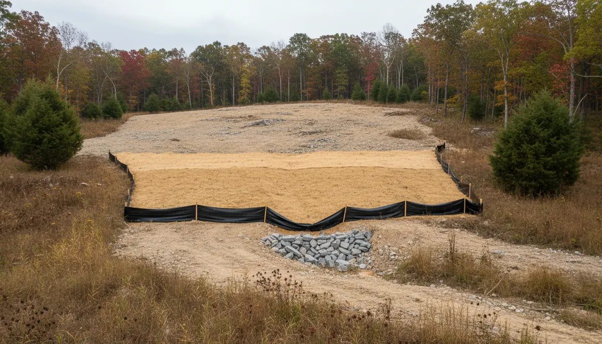
Erosion control services in Clarksville, TN are a compliance product before they are a landscaping product. Above one acre of disturbance the measures, the schedule, the documentation and the person signing the inspection are all named in permit conditions, and a site can be perfectly tidy and still be out of compliance because the record is missing. That is the part local quotes tend to leave out, and it is the part that stops a concrete pour.
The physical case is plainer. This county takes 50.99 inches of rain a year, 14.60 of it across March, April and May, and freshly opened ground has nothing holding it. Sediment leaving a site ends up in a road ditch or a blue-line stream, and on karst over Ste. Genevieve and St. Louis limestone it can go straight into groundwater.
Control Packages We Install and Maintain
Four scopes, quoted separately because owners carry them differently.
Perimeter and inlet protection
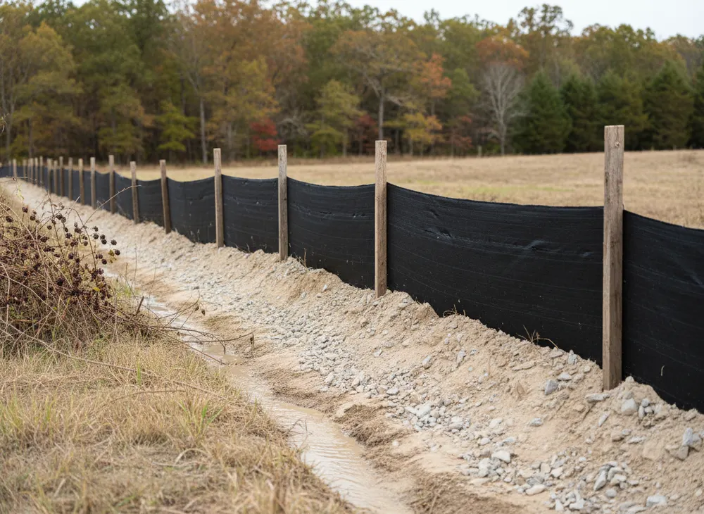
Silt fence on the downgradient boundary, storm drain inlet protection, check dams where flow already has a path.
Conveyance and outlet structures
Earth dikes, drainage swales, pipe slope drains, level spreaders and rock outlet protection, sized to move water without cutting a channel.
Sediment traps and basins
Basins and traps where contributing area is too large for perimeter measures alone.
Stabilisation and maintenance rounds
Seeding, matting and repeat visits, because a control never touched again stops working within a few storms.
The Measures the Permit Names, One by One
The permit lists these directly, and each one does a different job.
Barriers: silt fences and check dams
Silt fence slows sheet flow at a perimeter and drops suspended solids. Check dams do the same inside a channel. Both fail the same way, installed across concentrated flow they were never sized for.
Conveyance: dikes, swales, pipe slope drains, level spreaders
These move water off disturbed ground rather than letting it find its own line. Level spreaders and rock outlet protection hand it back without scouring the discharge point.
Storage: sediment traps and basins
Where flow cannot be treated at the edge it gets held long enough to drop its load. This measure scales with contributing acreage, not perimeter length.
Getting a Package In and Keeping It Alive
Five steps. Two repeat every week the site is open.
-
Map flow before choosing measures
Where water enters, concentrates and leaves. The design input is contributing area and slope.
-
Install before the first pass
Controls go in ahead of the machines creating the exposure, not after the first storm.
-
Phase the exposure
Opening ground in blocks matched to the earthwork keeps the control load manageable.
-
Inspect on the cadence and write it down
Twice weekly, no less than 72 hours apart, plus immediately before and after rain, by someone certified to do it.
-
Stabilise and remove in order
Seed or mat inside the deadline, then pull temporary measures once the ground behind them holds.
The Permit, the Clock and the Certified Inspector
What pulls a site into the programme, and when
Coverage under the Tennessee construction general permit, number TNR100000, is triggered by clearing, grading or excavation resulting in an area of disturbance of one or more acres, or by a smaller area forming part of a larger common plan of development. The notice of intent goes in with a site-specific stormwater pollution prevention plan attached, and the permit states that the complete application should be submitted at least thirty days before construction activities commence. Montgomery County runs a parallel requirement under Resolution #13-2-2: Grading, Drainage and Erosion Control plans before any earth disturbing activity begins. Two submittals, two lead times, and neither shortens because a subcontractor is free next week.
Deadlines, buffer width and the seventy-two hour rule
Once ground is open the permit runs on clocks. Temporary or permanent stabilisation is required within two weeks after construction activity in that portion of the site has ceased, and within one week where the activity was on a steep slope. A 30-foot natural water quality riparian buffer is to be preserved between a waterbody and the disturbed area to the maximum extent practicable, with a floor of more than 15 feet at any measured location. Inspection is the condition most often failed: the county requires controls to be inspected by someone holding Tennessee EPSC Level 1 certification at least twice a week and no less than 72 hours apart, with an inspection documented immediately before and after a rain event, and a valid pollution prevention plan kept on site. On sites over fifty acres the state permit adds inspection after any rainfall greater than half an inch in twenty-four hours. Two inspections stacked on a Thursday and a Friday do not satisfy a week.
What a Control Package Costs to Run
A permit layer of $250 to $6,000 by acreage band, plus crew and machine time
Fee schedules come from the county and state documents, not a national average.
| Scope | Typical range | What it covers |
|---|---|---|
| State stormwater coverage, initial | $250 at 1 to 5 acres, $1,000 at 5 to 20, $3,000 at 20 to 50, $6,000 at 50 to 150 | Subsequent coverage under a larger plan, $100. |
| State annual maintenance, projects past a year | $125, $500, $1,000 and $2,000 in the same acreage bands | Picked up by any programme past twelve months. |
| County permit layer | $65 per acre grading permit, $50 per acre plan review, $10 archives | Subdivision work tiered, $250 to $1,000 by acreage. |
| Crew and machine time for installation | $110 to $250 per hour, or $2,600 to $4,000 per day | Tennessee day rate for machine and operator. |
| EPSC Level 1 certification | $150, seven professional development hours | Fundamentals of Erosion Prevention and Sediment Control. |
What moves the price
- Disturbed acreage, which sets fee bands and package size.
- Slope, since moderate grades add 20 to 30 percent, steep ground 40 to 60.
- Whether a blue-line stream crosses the parcel, bringing the buffer in.
- Programme length, since twelve months adds annual state fees.
- Phasing, since less ground open means fewer measures.
Six acres of phased disturbance running fourteen months. State coverage in the 5 to 20 acre band is $1,000, and crossing a year adds $500 in annual maintenance. The county adds $390 at $65 per acre, $300 in review at $50 per acre and a $10 archives fee. That is $2,200 in fees, before the inspection burden: twice a week for sixty weeks is about 120 certified inspections.
Reasons to Contract This Separately
The record is the deliverable
Inspection logs, the on-site plan and the dates are what an inspector asks for first.
Certification named, not implied
The cadence is worth nothing unless the person doing it holds Tennessee EPSC Level 1.
Measures sized to flow
We map where water concentrates before quoting, because most failures are good measures in the wrong place.
Compliance Questions From Site Managers
What exactly does the seventy-two hour inspection rule require?
The county requires stormwater controls inspected at least twice a week with no less than 72 hours between inspections, by someone holding Tennessee EPSC Level 1 certification, plus a documented inspection immediately before and after a rain event. Two inspections on consecutive days do not satisfy the week.
Does forestry mulching reduce what we owe on erosion control?
No. The trigger is acreage of soil disturbance, not the method. A mulched acre is a disturbed acre. Grinding vegetation in place does leave material as cover, which helps physically, but it changes nothing about permit coverage, inspection cadence or the stabilisation deadline.
How long can ground sit open before it has to be stabilised?
Within two weeks after construction activity in that portion of the site has ceased, and within one week on steep slopes. The clock runs per portion of site, which is the argument for phasing.
What has to stay on site, physically?
A valid stormwater pollution prevention plan developed for that specific site, plus the inspection records. A plan sitting in an office is not a plan on site.
We have a creek along one boundary. What changes?
A 30-foot natural water quality riparian buffer is to be preserved between the waterbody and disturbed ground to the maximum extent practicable, floored at more than 15 feet at any measured location. That is preservation, not stream work. Altering a stream or wetland is a separate state permit with its own timeline.
Where Sediment Control Meets the Rest of the Job
Acreage clearing run to a plan set carries this as a line item, because commercial sites hit every trigger at once.
The earthwork these measures protect is where most of the exposure comes from, and the two are designed together.
The full pre-build sequence ends with controls installed and a record started.
A rural access run with real side ditching is often where sediment actually leaves a property, since a drive concentrates flow.
Book a Site Walk on Your Acreage
Send the parcel details and we will walk the ground, measure the disturbed area, check the stormwater threshold and put a written scope in front of you before any machine is booked.