Commercial Land Clearing in Southside, TN
Acreage cleared to a plan in the southeast corner of Montgomery County, phased so the exposed area stays small and the stormwater file stays clean.
Get a Free Land Clearing Quote in Clarksville
Tell us the acreage, the road it fronts and what the ground has to do afterwards. Form requests are answered the same working day, and every quote follows a site walk.
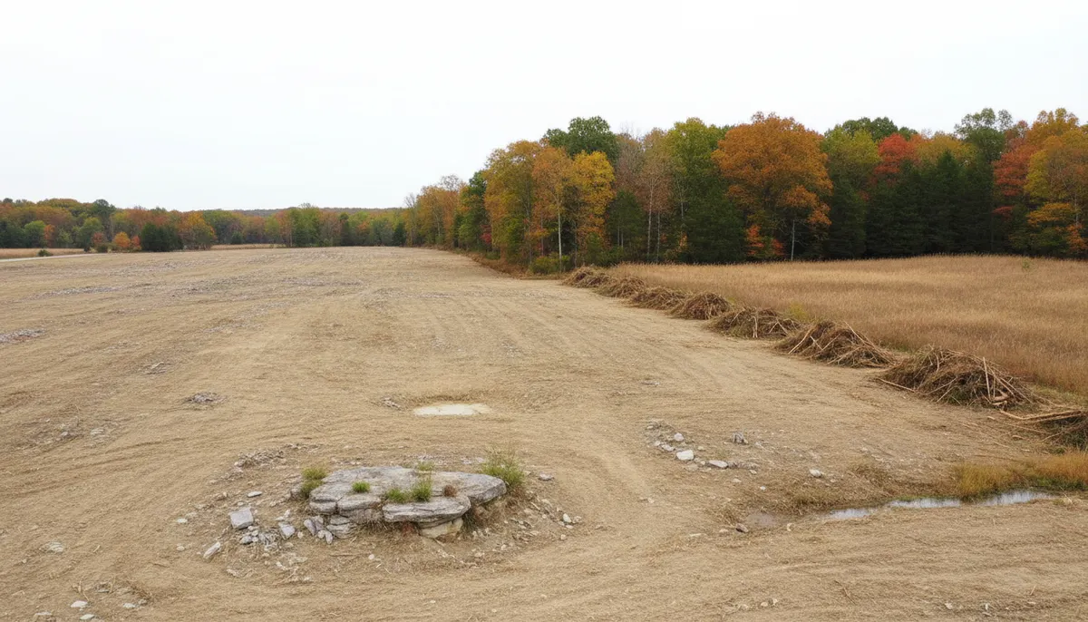
Southside occupies the southeast corner of Montgomery County about 11.5 miles south-southeast of Clarksville, holds roughly 1,552 people on the 2023 American Community Survey five-year figures, and has no municipal government: it is unincorporated county ground with a ZIP code, 37171, that outlived its own post office, which closed on 12 October 2002. The place was originally called Collinsville. What it has now is frontage on the US 48 and SR 13 corridor, which is the road that carries commercial and industrial interest out of Clarksville toward the south end of the county.
Clarksville Elite Land Clearing handles commercial land clearing on that ground, which is a different discipline from residential work in one specific way: the site plan, the permit file and the inspection record are part of the deliverable, not paperwork attached afterwards. On a commercial parcel the acreage of disturbance sets the permits, the permits set the controls, and the controls set the sequence of the work. Where the scope is a building pad rather than a whole tract, it belongs with site preparation, and where the finished levels matter more than the vegetation it belongs with land grading.
What a Commercial Site in Southside Has to Deal With
Three conditions govern commercial acreage in this corner of the county.
Growth arriving down the corridor
Montgomery County reached an estimated 249,935 people by 1 July 2025, up 13.6 percent since the 2020 census, in 539 square miles of land at 408 people per square mile. A metro of a quarter of a million inside a county that is still overwhelmingly rural outside the city boundary is the whole commercial land story here. On the north end of the county the NorthPark Logistics build is putting 14 buildings and 2.1 million square feet on 200 acres next to the LG Chem plant, with a first phase near 550,000 square feet. The pressure that project represents does not stay where it started, and the US 48 and SR 13 corridor is one of the routes it travels.
Karst under the pad
Montgomery County carries well-developed karst topography and cave systems, and the USGS records that sinkholes are most common where the thickest relatively pure limestones, the Ste. Genevieve and the St. Louis, crop out. Two consequences apply to a commercial pad. Grubbing and dozer work can drop into a void that gives no warning at the surface. And stormwater leaving a stripped acre on karst goes to groundwater rather than along a ditch to a surface stream, which changes where sediment ends up and makes the controls at the low end of the site more important than a standard detail sheet suggests.
Perched water and the construction calendar
The upland soils here are silt loams of the Dickson, Mountview and Pembroke pattern, and the Dickson series carries a fragipan, a dense restrictive layer that perches water above it after rain. Annual precipitation is 50.99 inches with the spring block of March through May totalling 14.60 inches and May alone at 5.72, against 2.95 inches in August. For a commercial programme that is a scheduling input rather than trivia. Stripped ground in April holds water, hauls badly and takes stabilisation seed poorly, and a phased clearing sequence is what keeps a spring start from becoming a stormwater problem.
Commercial Clearing Permits That Apply in Southside, TN
Southside is unincorporated, so there is no city permit counter in the middle of this and Montgomery County is the local authority throughout. Facts below were checked on 30 July 2026.
Commercial projects have their own sentence in the county rules
Montgomery County states that commercial, industrial, assembly and educational projects disturbing more than one acre must submit Grading, Drainage and Erosion Control plans before a permit is issued. Those plans have to be in before any earth disturbing activity begins, and the issuing office is the county Building and Codes Department. The governing instrument is Montgomery County Stormwater Management Regulations Resolution #13-2-2, which the county administers under TDEC Small MS4 Permit number TNS 075621. Because there is no municipality here, that county file is the only local file, which in practice makes the sequence simpler than an in-city job and no more forgiving.
What the acreage costs at each counter
County fees on the land disturbance application are $65 per acre for the grading permit, $50 per acre for plan review and a $10 archives and records fee, with subdivision projects instead tiered from $250 to $1,000 by disturbed acreage. State coverage runs alongside under construction general permit TNR100000, applied for on notice of intent form CN-0940 at least 30 days before construction starts, with initial fees of $250 at 1 to 5 acres, $1,000 at 5 to 20 and $3,000 at 20 to 50. A project running beyond a year carries an annual maintenance fee as well, $125 at 1 to 5 acres and $500 at 5 to 20.
The inspection regime is where commercial jobs actually fail
Montgomery County requires stormwater controls to be inspected by someone holding Tennessee EPSC Level 1 certification at least twice a week and no less than 72 hours apart, with an inspection performed and documented immediately before and after a rain event, and a valid stormwater pollution prevention plan kept on site. The state permit adds inspection twice per week on sites over 50 acres and after any rainfall over half an inch in 24 hours, stabilisation within two weeks of activity ceasing in an area and within one week on steep slopes, and a 30-foot riparian buffer preserved to the maximum extent practicable. Clearing that ignores that cadence produces a file that fails later even when the ground looks fine.
Sources for the requirements above:
- Montgomery County Building and Codes permit types, for the commercial plan requirement (https://montgomerytn.gov/building-codes/permit-types)
- Montgomery County General SWPPP, for Resolution #13-2-2 and the EPSC inspection cadence (https://montgomerytn.gov/storage/departments/stormwater/SWMM%20Chapter%208%20County%20General%20SWPPP.pdf)
- Montgomery County Land Disturbance Permit Application, for the fee structure (https://montgomerytn.gov/storage/departments/stormwater/Land_Disturbance_Permit_Application.pdf)
- TDEC construction general permit TNR100000, for coverage and fee bands (https://www.tn.gov/environment/permit-permits/water-permits1/npdes-permits1/npdes-stormwater-permitting-program/npdes-stormwater-construction-permit.html)
- TDEC EPSC Level 1 training, for the certification the county inspection rule names (https://tnepsc.org/level1.html)
Where We Clear Around Southside
There is no corporate limit here, so the working area is the 37171 ZIP and the roads that feed it. The US 48 and SR 13 corridor is the spine, running south out of Clarksville toward the county line, and commercial frontage in this part of the county is arranged along it rather than in a grid. Roughly 1,552 people live across that area, which means a commercial parcel here usually has agricultural neighbours rather than commercial ones, and the sediment leaving your site lands on someone's hay ground rather than in a municipal inlet.
Historic Collinsville, the living history museum that carries the community's original name, and Lafayette Furnace, which is listed on the National Register of Historic Places, are the two fixed landmarks in the area. They are worth knowing on a clearing job for a practical reason as well as a local one: ground near a recorded historic resource is ground where a scope gets checked more carefully before a machine starts, and it is cheaper to establish that at the walk-over than after.
The parcel pattern in this corner is the county pattern. Montgomery County subdivision rules exempt splits creating tracts of five acres or more from Planning Commission review where no street or utility is built, so the rural fringe is built out of five-acre and larger tracts, and a commercial assembly here is usually several of them joined rather than one large holding with one clean boundary. That matters because acreage of disturbance is calculated across the whole common plan, not parcel by parcel, and a phased build that looks like three small jobs is one permit.
Where a commercial owner only needs a corridor cut rather than a tract cleared, the work is closer to right of way clearing and priced by the run rather than the acre. North toward the interstate the same corridor feeds the residential pressure described under clearing for home building in Sango.
Land Clearing Services Available in Southside
The scopes commercial owners in this corner of the county ask for most.
Commercial Land Clearing
Acreage cleared against a site plan, phased to keep the exposed area small, with the permit file and the inspection record maintained as part of the work.
Erosion Control
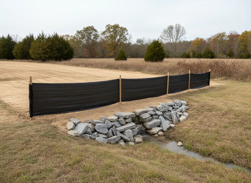
Silt fence, check dams, sediment traps and inlet protection installed and inspected on the cadence the county and the state permit both set.
Site Preparation
From cleared ground to a pad a builder can work from, with subgrade, access and laydown in the right places before the first delivery arrives.
Land Grading
Finished levels and positive fall set to plan, which on karst ground is as much about where the water is sent as about the elevations on the sheet.
How We Work in Southside
-
Measure the disturbance before anything else
Total disturbed acreage across the whole common plan, not the first phase, because that single number sets the county permit, the state coverage and both fees.
-
Plans and controls in before the blade
Grading, drainage and erosion control plans submitted, notice of intent filed 30 days ahead, controls installed and the plan kept on site from day one.
-
Clear in phases and stabilise behind
Only the area being worked is opened, stabilisation follows within the two-week deadline, and the inspection record is kept to the twice-weekly cadence.
Nearby Communities We Serve
Gravel driveway installation at Cunningham is the neighbouring crossroads west where SR 13 meets SR 48, under the same county permitting.
Land clearing for home building in Sango covers the growth wedge north of here between US 41A and I-24, where the pressure is residential rather than commercial.
Brush clearing around Pleasant View picks up southeast across the Cheatham County line, where a different county and an incorporated town both apply.
Selective clearing at Palmyra is the river ground west of here on SR 149, also unincorporated Montgomery County.
Book a Site Walk on Your Acreage
Send the parcel details and we will walk the ground, measure the disturbed area, check the stormwater threshold and put a written scope in front of you before any machine is booked.